As-Built Documentation Services
What is 3D laser scanning and as-built documentation?
3D Laser Scanning and As-Built Documentation is the process of capturing accurate, real-world measurements of existing structures, sites, or assets using high-precision 3D laser scanners and converting the collected data into reliable digital records. The scanning process generates detailed point cloud data that represents the exact geometry and spatial relationships of physical conditions as they exist on site.
This data is then used to create as-built documentation, including 2D drawings, 3D CAD models, or BIM models, which accurately reflect the current state of the asset. These deliverables are essential for renovation, retrofit planning, clash detection, quality verification, facility management, and ensuring design decisions are based on precise, up-to-date information.
As-built documentation is particularly useful for architects, engineers, and construction professionals during renovation projects and facility management or to validate the constructed building against the proposed design. By providing an extremely accurate depiction of the structure, it mitigates the risk of design or construction errors and can save significant time and money.
Key Aspects of 3D laser scanning and as built doucmentation:
- Accuracy: It takes exact measurements and details
- Point Cloud Data: It creates a detailed digital model using millions of data points
- As-Built Records: It keeps track of how things were actually built, including any changes from the original plans
- Digital Blueprints: It makes exact digital copies of the built environment
- Applications: It is helpful for things like renovation, managing facilities, ensuring quality, and other similar tasks
- Time and Cost Savings: It reduces the need for on-site visits, helps avoid mistakes, and cuts down on redo work
3D laser scanning technology is highly effective, capturing millions of data points to create precise digital models. This capability enhances workflows and mitigates risks in construction and facility management projects, showcasing its significant potential benefits.
These data points, also known as a point cloud, can be used to generate a 3D model, floor plans, sections, elevations, and other critical details about the building. 3D laser scanning is a technology that uses 3D laser light to capture the shape and size of an object or environment in three dimensions. It works by emitting a laser beam that sweeps across the object or scene, measuring the distance and angles of the reflected light. This data is then used to create a highly accurate 3D digital model, often in the form of a point cloud.
Why are 3D laser scanning and as-built documentation important?
3D laser scanning and as-built documentation are essential in construction and facility management. They help ensure accuracy by capturing exact measurements and details, which lowers the chance of mistakes and helps spot any differences from the original designs. This technology helps save time and money by reducing the need for repeated site visits, fixing errors, and avoiding disagreements. It also helps everyone involved in a project work better together through the use of accurate digital models. Plus, it supports facility management by giving dependable records for maintenance and day-to-day operations. It also helps with following regulations by keeping a clear record of how the actual construction was done.
What are the common challenges in 3D laser scanning and as-built documentation?
3D laser scanning and as-built documentation present several challenges. These include dealing with large amounts of data and point clouds, making sure the data is accurate and precise during capture and processing, and handling complex shapes or areas that are hard to access. The cost of buying the necessary equipment and software can also be a problem. It's also tough to combine the 3D scan data with other systems and software, and you usually need experts to properly capture and process the data. Things like weather and lighting can also affect how good the data is.
Related Services
Some related services to 3D laser scanning and as-built documentation include:
- 3D Modeling: Creating detailed digital models from 3D scan data
- BIM (Building Information Modeling): Developing intelligent digital models for construction and facility management
- Surveying: Conducting land surveys and topographic mapping
- Photogrammetry: Capturing 3D data using aerial or terrestrial photography
- Reality Capture: Documenting existing conditions using various technologies
- CAD Design: Creating detailed digital designs for construction and manufacturing
These services often complement 3D laser scanning and as-built documentation, providing a comprehensive solution for construction, architecture, engineering, and facility management projects.
The Process
3D laser scanning and as-built documentation processes are designed to deliver accuracy, efficiency, and full transparency throughout a project. The workflow follows these important steps:
- Project Planning: We start by understanding the goals of the project, what needs to be delivered, and what the client expects. We also check the site conditions to make sure everything is set up properly for the work ahead.
- Site Preparation: Before we begin scanning, we ensure the site is safe and easy to access. We also set up reference points and prepare the area to help us get the most accurate data possible.
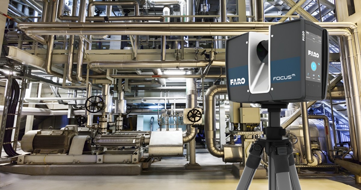
- Data Capture: We use high-tech 3D laser scanning tools to collect detailed measurements of the site or structure. This creates a very detailed 3D image made up of millions of points, called a point cloud.
- Data Processing: Once we have all the scan data, we organize and align it to form one complete point cloud. We also remove any mistakes or unwanted data to make sure the information is reliable and accurate.
- Modeling and Documentation: From the processed data, we create detailed 3D models, 2D drawings, and accurate as-built documentation that reflects the actual state of the site or building.
- Quality Control: We carefully check all the final outputs to make sure they match the real-world measurements and meet the required standards of accuracy.
- Final Delivery: We provide the client with all the project results, including 3D models, 3D CAD drawings, and detailed reports, in the format they prefer.

What are the applications of 3D laser scanning and as-built documentation across various industries?
- Architecture, Engineering, and Construction (AEC): Supports renovation, design validation, clash detection, and facility management by providing accurate building data, identifying discrepancies, spotting system conflicts, and creating digital records for maintenance and operations.
- Oil, Gas, and Petrochemical Industry: For plant revamps and expansions, 3D laser scanning ensures existing facilities are accurately recorded for changes or additions. It creates detailed models for pipeline and equipment inspection, aiding in checking, tracking, and maintenance. This technology also enables effective shutdown and turnaround planning by providing precise facility information, reducing downtime, and optimizing project schedules.
- Industrial Manufacturing: 3D laser scanning enables layout optimization by documenting the existing production area setup, facilitating precise planning for new machinery placement. It ensures accurate machinery alignment, positioning systems exactly where needed. Additionally, it allows for digital twin creation, providing a virtual replica of factory equipment for testing, monitoring, and optimizing operations.
- Infrastructure and Transportation: 3D laser scanning supports infrastructure projects like bridges, tunnels, and roads by capturing and verifying existing conditions for planning and improvement. It's also used in railway and metro systems for design validation, clearance checks, and maintenance. In airports and ports, detailed models enable efficient space planning and operational management.
- Power and Energy Sector: 3D laser scanning supports the creation of detailed models for thermal and nuclear power plants, aiding in maintenance, upgrades, and regulatory compliance. It's also used in renewable energy facilities like wind farms, solar plants, and hydroelectric systems to accurately document and track equipment.
Why Choose RA Global?
At RA Global, we provide industry-leading service in 3D laser scanning. Additionally, we offer Scan to BIM 3D Modelling or 3D Scan to 3D CAD Modelling. RA Global is a reliable choice for 3D laser scanning and As-Built documentation, offering accurate data capture and precise documentation
- Accuracy: RA Global's 3D laser scanning services provide highly accurate data capture, ensuring precise as-built documentation
- Expertise: Our team has extensive experience in 3D laser scanning and as-built documentation, delivering high-quality results
- Technology: RA Global utilizes advanced 3D laser scanning technology to capture complex site conditions and equipment details
Require 3D Laser Scanning? Contact us for your surveying requirements and local Faro 3D laser scanning services in India.
Frequently Asked Questions
What is 3D laser scanning?
It is a high‑precision method that captures millions of spatial data points, creating accurate digital models of existing structures, equipment, or sites.
Why use as‑built documentation services?
They provide reliable, up‑to‑date digital records that help with renovation, facility management, clash detection, and future design or engineering work.
Which industries need 3D laser scanning?
Architecture, construction, oil and gas, industrial plants, heritage preservation, and engineering projects benefit from precise as-built documentation and scanning.
Can you scan complex or hard‑to‑reach areas?
Yes! Our advanced scanning equipment captures detailed data even in confined, high, or irregular spaces safely and efficiently.
What formats do you deliver scanned data in?
We provide point clouds, 3D CAD models, 2D drawings, and BIM formats, compatible with your design, planning, and documentation workflows.